Be Better! ...get the settings sets.
Showing posts with label Google Earth. Show all posts
Showing posts with label Google Earth. Show all posts
Wednesday, August 18, 2010
If Importing Google Earth Surface Stops
I was recently contacted by a few Civil 3D users that were attempting to import a Google Earth surface into their drawings. The importation process would stop at about 49%. I made the following video to address their issue.


Tuesday, February 24, 2009
FEMA Flood Hazard Areas in Google Earth

The title of this post is linked to a FEMA Mapping download page where we can download two KMZ files that show flood hazard areas and related info in Google Earth.
We have previously seen that Google Earth data (image and 3D surface) can be easily brought into Civil 3D.
Many will find this information very useful.
Be Better! ...Stay high and dry!
Tuesday, February 03, 2009
Google Earth 5
There are some interesting new features in the new Google Earth 5 Beta (click on the title of this post to get to the download page). One that I found interesting was the ability to use/load past imagery. I was able to see what the nearby vicinity looked like in 1994 as compared with today.


1994

The present

We can also now see underwater features. I was able to see the seabed between the coast and Catalina Island. I was able to import the seabed data into Civil 3D 2009 and the image was draped on the surface as expected.


Check the somewhat new "Being Civil" blog to see how to get this to work fine.
Be Better!...Remember the Past.
Monday, May 21, 2007
Drape Image - Skill Builder
This skill builder has been available for a little while, but I had not had the opportunity to mention it yet. The 14-page "Skill Builder" titled "Draping an Image on a Surface Using AutoCAD Civil 3D 2008" shows us how to just that. This includes...
- Setting up a surface style
- exporting design data to Google Earth to locate appropriate image location
- Fine tuning Google Earth for suitable image
- Importing Google Earth image
- Draping image on to Civil 3D 2008 surface
Friday, February 16, 2007
Civil 3D 2008 Will Give You The Earth
 Google Earth that is. One of the new capabilities that Civil 3D 2008 will have is the ability to import an image and surface right from Google Earth. So, if my target drawing has a Geodetic Zone assigned we will get a free starting point for projects.
 That means that my two favorite applications will have bi-directional data sharing. Excellent!
Wednesday, February 14, 2007
Autodesk's Official 2008 Press Releases
On Monday many websites carried Autodesk's official press releases about the 2008 family of products. Here are a couple as carried by Yahoo!:
AutoCAD 2008 & AutoCAD LT 2008
The item that caught my eye was the new annotation scaling capability (similar to Civil 3D labels) which will apply to things such as tables, text, and leaders.
AEC Products (Civil 3D, Architecture {new name}, & MEP {new name})
Most of the items related to Civil 3D caught my eye. Things like enhanced multiuser environment (I am assuming that this means Vault), automated sheet generation, and Google Earth interoperability.
Click on the links to read them yourself.
So this begins the official process of learning about, and then learning Civil 3D 2008.
AutoCAD 2008 & AutoCAD LT 2008
The item that caught my eye was the new annotation scaling capability (similar to Civil 3D labels) which will apply to things such as tables, text, and leaders.
AEC Products (Civil 3D, Architecture {new name}, & MEP {new name})
Most of the items related to Civil 3D caught my eye. Things like enhanced multiuser environment (I am assuming that this means Vault), automated sheet generation, and Google Earth interoperability.
Click on the links to read them yourself.
So this begins the official process of learning about, and then learning Civil 3D 2008.
Tuesday, December 19, 2006
Where On Earth Is This Data?
One of the simplest things that we can do for our drawings that will make them significantly more useful is to assign a Geodetic Zone - Category & Coordinate System for the drawing. If we then use the state plane coordinate data as opposed to an assumed coordinate we will be able to...
1. Intermingle/Gathering data from various other Coordinate Systems seamlessly.
2. Transfer Civil Data from Civil 3D to Google Earth more accurately (vs. UTM or Lat/Long data)
The steps as outline in HELP are as follows:
1. In Toolspace, on the Settings tab, right-click the drawing and click Edit Drawing Settings.
2. In the Drawing Settings dialog box, click the Units and Zone tab.
3. Under Drawing Units, select either Feet or Meters.
4. Under Angular Units, select an angle format.
5. Under Scale, select a scale.
6. From the Categories list, select a zone category.
7. Categories include Lat/Longs, US states, and so on.
When you select a category, the Available Coordinate Systems list displays all the defined zones in that category.
Tip: If you know the coordinate system (CS) code for a zone, you can enter it in the CS Code text box and click OK to select the zone.
8. Select the zone.
9. Click OK.
I did not know what the ground coordinates were for the location of the KETIV Technologies offices here in Fullerton, CA. I did know that we were in NAD83 California State Planes, Zone VI, US Foot (AKA. CA83-VIF). By assigning this to a drawing and some trial and error with the "Publish to Google Earth..." command I now know that the center of our offices are at...
X = 6064787.1131 Y = 2265863.0846 or
Northing = 2,265,863 Easting = 6,064,787
By assigning the Category and Coordinate System my drawing now knows where in the world it is.
Note: Obviously, if all we know is an assumed coordinate location this is NOT possible.
1. Intermingle/Gathering data from various other Coordinate Systems seamlessly.
2. Transfer Civil Data from Civil 3D to Google Earth more accurately (vs. UTM or Lat/Long data)
The steps as outline in HELP are as follows:
1. In Toolspace, on the Settings tab, right-click the drawing and click Edit Drawing Settings.
2. In the Drawing Settings dialog box, click the Units and Zone tab.
3. Under Drawing Units, select either Feet or Meters.
4. Under Angular Units, select an angle format.
5. Under Scale, select a scale.
6. From the Categories list, select a zone category.
7. Categories include Lat/Longs, US states, and so on.
When you select a category, the Available Coordinate Systems list displays all the defined zones in that category.
Tip: If you know the coordinate system (CS) code for a zone, you can enter it in the CS Code text box and click OK to select the zone.
8. Select the zone.
9. Click OK.
I did not know what the ground coordinates were for the location of the KETIV Technologies offices here in Fullerton, CA. I did know that we were in NAD83 California State Planes, Zone VI, US Foot (AKA. CA83-VIF). By assigning this to a drawing and some trial and error with the "Publish to Google Earth..." command I now know that the center of our offices are at...
X = 6064787.1131 Y = 2265863.0846 or
Northing = 2,265,863 Easting = 6,064,787
By assigning the Category and Coordinate System my drawing now knows where in the world it is.

Note: Obviously, if all we know is an assumed coordinate location this is NOT possible.
Monday, November 06, 2006
2007 Autodesk Civil Engineering Solutions (ACES) Service Packs
I have been receiving inquiries for the following, so here is a more complete list of Service Packs that were recently made available, and the order in which they would typically be installed:
Autodesk Data Management Server 5 Service Pack 1 - Sep. 18, 2006
Civil 3D 2007 Service Pack 3 - Nov. 4, 2006
Google Earth™ Extension for Civil 3D® 2007 Service Pack 3 - Nov. 4, 2006
Land Desktop Companion 2007 Service Pack 2 - Nov. 4, 2006
or
Land Desktop 2007 Service Pack 2 - Nov. 4, 2006
Civil Design Companion 2007 Service Pack 2 - Nov. 4, 2006
Survey 2007 Service Pack 1 - Nov. 4, 2006
Raster Design 2007 Service Pack 1 - Nov. 2, 2006
Autodesk Data Management Server 5 Service Pack 1 - Sep. 18, 2006
Civil 3D 2007 Service Pack 3 - Nov. 4, 2006
Google Earth™ Extension for Civil 3D® 2007 Service Pack 3 - Nov. 4, 2006
Land Desktop Companion 2007 Service Pack 2 - Nov. 4, 2006
or
Land Desktop 2007 Service Pack 2 - Nov. 4, 2006
Civil Design Companion 2007 Service Pack 2 - Nov. 4, 2006
Survey 2007 Service Pack 1 - Nov. 4, 2006
Raster Design 2007 Service Pack 1 - Nov. 2, 2006
Tuesday, September 05, 2006
SP2 and Google Earth Extension Conflict
Not everyone reads the Readme file for every application that they install. It is not realistic to expect everyone to read them all. But, here is a heads up about a note in the Civil 3D 2007 Service Pack 2 readme file. It reads...
Important: Version 1 of the Google Earth Extension is only compatible with Autodesk Civil 3D 2007 and Service Pack 1 or 1A and will be disabled after you install Autodesk Civil 3D 2007 Service Pack 2. In order to use the Google Earth Extension, after installing Autodesk Civil 3D 2007 Service Pack 2, you must download and install Release 2 of Google Earth Extension.
This has caused some users problems. Uninstalling the extension has usually fixed the issue. By the way, according to the Autodesk website, Release 2 of Google Earth Extension will be posted soon.
Important: Version 1 of the Google Earth Extension is only compatible with Autodesk Civil 3D 2007 and Service Pack 1 or 1A and will be disabled after you install Autodesk Civil 3D 2007 Service Pack 2. In order to use the Google Earth Extension, after installing Autodesk Civil 3D 2007 Service Pack 2, you must download and install Release 2 of Google Earth Extension.
This has caused some users problems. Uninstalling the extension has usually fixed the issue. By the way, according to the Autodesk website, Release 2 of Google Earth Extension will be posted soon.
Thursday, July 27, 2006
Autodesk Labs
I am not certain why I had not mentioned this before, but Autodesk has a new section at their website where they are making available new stuff under development. Non-disclosure agreements are not required. This makes the technology previews available "public betas" (with all of the disclaimers that go along with that). The new section is called Autodesk Labs.
There are currently three previews available
Autodesk DGNV8 Translator Beta - Added June 19th, 2006
Installs on all language versions of:
AutoCAD 2007
Autodesk Architectural Desktop 2007
Autodesk Building Systems 2007
AutoCAD Electrical 2007
AutoCAD Mechanical 2007
Google Earth Extension Beta - Added June 28th, 2006
Installs on all language versions of:
AutoCAD 2007
Architectural Desktop 2007
AutoCAD Civil 3D 2007
AutoCAD Map 3D 2007
Project Freewheel Technology Preview - Added July 4th, 2006
Freewheel is both a web site where you can type in an DWF URL for interactive viewing, and a web service that allows you to embed an interactive DWF viewer in your own HTML page.
The main reason I thought to mention this now was that someone asked in a discussion group how to get basic AutoCAD entities into Google Earth. The "Google Earth Extension Beta" would likely work best for him.
There are currently three previews available
Autodesk DGNV8 Translator Beta - Added June 19th, 2006
Installs on all language versions of:
AutoCAD 2007
Autodesk Architectural Desktop 2007
Autodesk Building Systems 2007
AutoCAD Electrical 2007
AutoCAD Mechanical 2007
Google Earth Extension Beta - Added June 28th, 2006
Installs on all language versions of:
AutoCAD 2007
Architectural Desktop 2007
AutoCAD Civil 3D 2007
AutoCAD Map 3D 2007
Project Freewheel Technology Preview - Added July 4th, 2006
Freewheel is both a web site where you can type in an DWF URL for interactive viewing, and a web service that allows you to embed an interactive DWF viewer in your own HTML page.
The main reason I thought to mention this now was that someone asked in a discussion group how to get basic AutoCAD entities into Google Earth. The "Google Earth Extension Beta" would likely work best for him.
Friday, May 26, 2006
Civil 3D 2007 - Extension for Google Earth
Autodesk made available yesterday the Autodesk Civil 3D 2007 Extension for Google Earth is a NEW Technology Preview that will allow Civil 3d 2007 users to publish significantly more to Google Earth than does the hidden command EXPORTGOOGLEEARTH.
This Extension will allow the exporting of Points, Parcels, Alignments, Corridor models, Surfaces, and Pipe Networks directly to Google Earth.
In order to install you must have both Civil 3D 2007 and any version of Google Earth (Free, Plus, Pro) installed.
Note: When you install you will get two drawings that you can practice exporting to Google earth
This Extension will allow the exporting of Points, Parcels, Alignments, Corridor models, Surfaces, and Pipe Networks directly to Google Earth.
In order to install you must have both Civil 3D 2007 and any version of Google Earth (Free, Plus, Pro) installed.
Note: When you install you will get two drawings that you can practice exporting to Google earth
Friday, May 05, 2006
Speaking of Google Earth
As of a week ago Google made SketchUp FREE for personal use.
SketchUp allows you to create 3D models or better yet import .DWG and .DXF and place that data into Google Earth.
Click on the title of this post to get it.
SketchUp allows you to create 3D models or better yet import .DWG and .DXF and place that data into Google Earth.
Click on the title of this post to get it.
Civil 3D 2007 - Corridor to Google Earth
There is so much to share, and not nearly enough time to do so. Here is a super quick item.
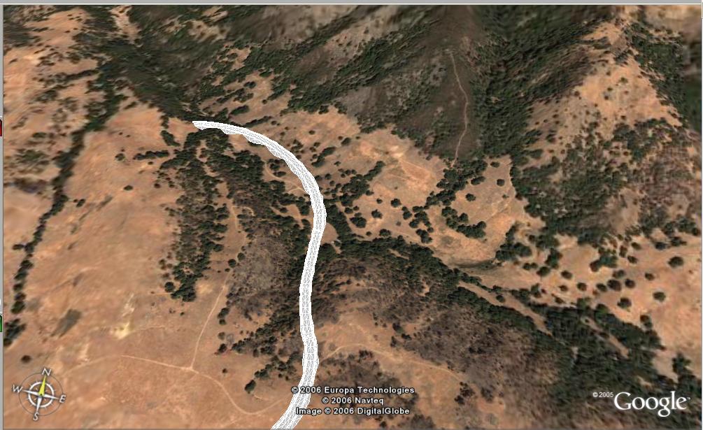
Today, during the webcast, Anthony Governanti, Technical Marketing Manager for Autodesk, shared a hidden command in Civil 3D 2007. EXPORTGOOGLEEARTH.
This command allows you to pick a corridor with a corridor surface in a drawing that has a coordinate system assigned and have the surface of the corridor exported to Google Earth.
Tuesday, April 11, 2006
Bootcamp Day Three - Vault, Map 3D, and Raster Design
Well, it was one busy day. Far too much information for just one post. Here is the smallest of tiny snippets.
The first half, 4 hours, was spent exploring Autodesk Vault. It will be like learning to ride a bike. It is not immediate. Ultimately, it is not incredibly hard, and actually can be somewhat empowering. A few will likely find it tough. But, with proper guidance it should be very useful. Remember I mentioned PROPER GUIDANCE. The fact that some will try to implement this on their own, the "We are engineers after all" group, will likely lead a few to some frustration. But then again, what does not. Even learning to tie your shoes had to be taught. There will be some change in how things are done, and some individuals and companies embrace change more willingly than others.
If we choose to embrace it (not necessary for small projects and project teams) it can be very useful. Because it is going to be new for most, and it requires certain steps and decisions that some would rather not make at this point in time, I can see some as avoiding it. But, that will be as futile as was avoiding the dawn of automobiles and aviation. Things will be different.
As for Map 3D and Raster Design. My favorite new ability was draping an image on a 3D surface with Raster Design. This definitely reminded me of Google Earth.
The first half, 4 hours, was spent exploring Autodesk Vault. It will be like learning to ride a bike. It is not immediate. Ultimately, it is not incredibly hard, and actually can be somewhat empowering. A few will likely find it tough. But, with proper guidance it should be very useful. Remember I mentioned PROPER GUIDANCE. The fact that some will try to implement this on their own, the "We are engineers after all" group, will likely lead a few to some frustration. But then again, what does not. Even learning to tie your shoes had to be taught. There will be some change in how things are done, and some individuals and companies embrace change more willingly than others.
If we choose to embrace it (not necessary for small projects and project teams) it can be very useful. Because it is going to be new for most, and it requires certain steps and decisions that some would rather not make at this point in time, I can see some as avoiding it. But, that will be as futile as was avoiding the dawn of automobiles and aviation. Things will be different.
As for Map 3D and Raster Design. My favorite new ability was draping an image on a 3D surface with Raster Design. This definitely reminded me of Google Earth.
Tuesday, January 03, 2006
Google Earth + DWG

Have you ever wanted to place your DWG into Google Earth? Well, now you can.
Avatech Solutions is providing the newly renamed "Avatech Earth Connector" FREE. This Google Earth Add-In allows you to introduce AutoCAD 3D Faces, Lines, and Plines into your Google Earth environment.
Google Earth is Excellent. Adding my DWGs makes it even better!
Simply click on the title of this post (above) to download the Add-In.
p.s. That is my house (created in Architectural Desktop).
Wednesday, June 29, 2005
Google Earth
I would commonly show Nasa World Wind to Civil Engineers and most would get excited about being able to have such a tool available to them for free.
Well as of yesterday, Google Earth took the concept of a 3D globe with images draped on to terrain to another level.
AECNew.com has an article that describes Google Earth and the potential ramifications to the AEC communities.
I am very impressed with Google Earth and am looking forward to finding out more of it's potential usages.
Well as of yesterday, Google Earth took the concept of a 3D globe with images draped on to terrain to another level.
I am very impressed with Google Earth and am looking forward to finding out more of it's potential usages.
Subscribe to:
Posts (Atom)
