I wish to thank everyone who took time out of their busy schedules to attend yesterday evening's A.C.E.S. User Group meeting. The turn out was awesome. About 75 attendees! One person timed a trip to Southern California from Colorado to be able to attend.
The feedback regarding the technical presentations (Raster Design, Map, Civil 3D Grading) was very positive.
I wish to additionally thank everyone who SHARED their knowledge and expertise, and those that contributed by asking good questions during the evening. It very much fulfilled the spirit of what a user group can be, and the three guiding principle of this group: Share, Network, Learn.
Last but not least, I wish to thank Eric Galvan, Autodesk, ISD-Business Development Executive-Western Region (Civil CAD Dude, inside joke) who was able to join us and provide input.
I am happy with how this group has gotten off the ground (pun), and I look forward to it's future. Based on some of the buzz this group should soar!
The next meeting is currently scheduled for Thursday, April 12, 2007. Please mark your calendars. I will keep you updated.
Showing posts with label Map. Show all posts
Showing posts with label Map. Show all posts
Friday, January 12, 2007


Saturday, November 04, 2006
Civil 3D 2007 Service Pack 3 Now Available
Serivice Pack 3 for Autodesk Civil 3D 2007 is now available for download. You will absolutely want to install it. With 100's of combined fixes (it also includes Civil 3D SP1A & SP2, Map SP1, SP2, & SP3, Acad SP1), and some excellent performance enhancements. This Service Pack is a must have.
If you are using Vault, the Autodesk Data Management Server 5 Service Pack 1 must be installed prior to installing C3D Service Pack 3.
Which reminds me to mention, read the download page and the readme. Many people ignore these items and then complain when a documented situation occurs to them. These items are not lengthy and can save a lot of time and heartache if someone has a documented special condition. Trust me it is well worth your time to go through these items.
OK, mine is updated.

If you are using Vault, the Autodesk Data Management Server 5 Service Pack 1 must be installed prior to installing C3D Service Pack 3.
Which reminds me to mention, read the download page and the readme. Many people ignore these items and then complain when a documented situation occurs to them. These items are not lengthy and can save a lot of time and heartache if someone has a documented special condition. Trust me it is well worth your time to go through these items.
OK, mine is updated.

Monday, October 23, 2006
Civil 3D - SP3 Update
Just a reminder that there will be a Service Pack 3 for Civil 3D 2007. It is expected in the next two weeks. We have been told that it will...
Restore non-projects shortcuts (with this some will choose to not implement Vault)
Performance improvements (such as 2X faster corridor processing, 5X faster contour label regen and more).
Includes most recent Service Packs for AutoCAD® 2007, Autodesk Map® 3D 2007, and Autodesk® Vault 5.
Restore non-projects shortcuts (with this some will choose to not implement Vault)
Performance improvements (such as 2X faster corridor processing, 5X faster contour label regen and more).
Includes most recent Service Packs for AutoCAD® 2007, Autodesk Map® 3D 2007, and Autodesk® Vault 5.
Monday, October 09, 2006
Civil 3D 2007 SP3 Info
During the webcast on Friday Oct 06, 2006 Dave Simeone, Autodesk Civil 3D Product Manager, gave some glimpses of what may likely be in Civil 3D 2007 Service Pack 3. These items include:
Civil 3D 2007 (SP1a, SP2 and NEW FIXES)
AutoCAD 2007 SP1
Map 3D 2007 SP3
Components of Vault SP1 (he made it clear, DO NOT INSTALL VAULT SP1 YET!)
He mentioned that users will likely see the following improvements:
2X Faster Corridor Processing Speed
50X Performance Jump in Project/Reference Interaction
Improved Surface Memory Usage (surface memory leaks have been an issue for some)
Stability Improvements
and (drum roll, please)
Restoration of Non-Projects Shortcuts
This last item translates to shortcuts that WILL ABSOLUTELY be remembered from session to session. No longer will we have to reload the .xml file from which we load data references. Remember data reference synchronization notifications. He also demonstrated a NEW ability to change the source file of a data reference (see image below).
So when is all this supposed to be available? They are aiming for the end of this month (October).
Civil 3D 2007 (SP1a, SP2 and NEW FIXES)
AutoCAD 2007 SP1
Map 3D 2007 SP3
Components of Vault SP1 (he made it clear, DO NOT INSTALL VAULT SP1 YET!)
He mentioned that users will likely see the following improvements:
2X Faster Corridor Processing Speed
50X Performance Jump in Project/Reference Interaction
Improved Surface Memory Usage (surface memory leaks have been an issue for some)
Stability Improvements
and (drum roll, please)
Restoration of Non-Projects Shortcuts
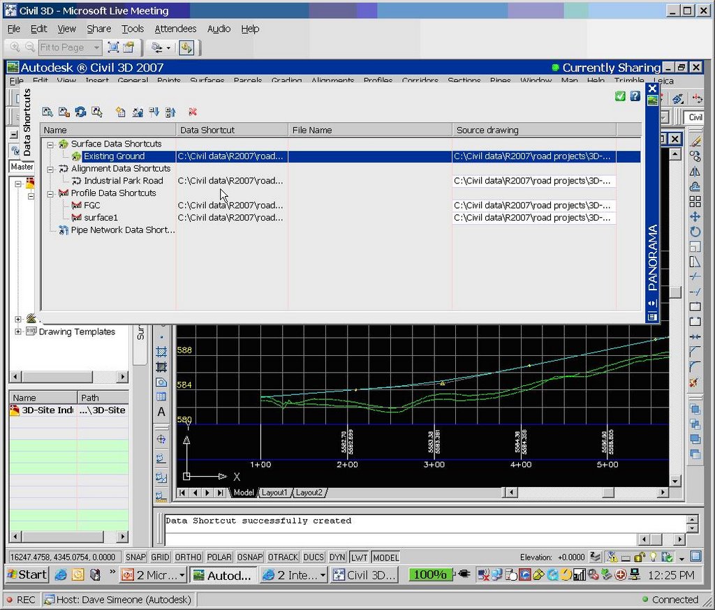
This last item translates to shortcuts that WILL ABSOLUTELY be remembered from session to session. No longer will we have to reload the .xml file from which we load data references. Remember data reference synchronization notifications. He also demonstrated a NEW ability to change the source file of a data reference (see image below).
So when is all this supposed to be available? They are aiming for the end of this month (October).
Wednesday, August 30, 2006
A.C.E.S. Flying into Southern California

The control tower has given final clearance for A.C.E.S. to land here in Southern Califonia. What is A.C.E.S. you may ask? A.C.E.S. is...
Autodesk Civil Engineering Solutions User Group of Southern California
You can join this squadron of novice, intermediate, and elite users of:
Civil 3D
Land Desktop
Civil Design
Survey
Raster Design
Map
AutoCAD
We can all see this group get off the ground together (Thursday, Oct. 5 @ 5:30pm) and attendees can help pilot its formation. I am also looking forward to meeting Pete Kelsey at the first meeting. Who is Pete Kelsey? You don't know. You will.
Click on any of the links to register.
Thursday, August 03, 2006
Civil 3D - SP2 Coming Soon
Service Pack 2 for Civil 3D 2007 will likely be available sometime next week. It should include Civil 3D 2K7 SP1A, and Map 2K7 SP1 & SP2.
Issues Resolved in Autodesk Civil 3D 2007 Service Pack 2
General
When closing the program, you no longer receive an error message after using the Object Property Manager.
Using the UNDO command after deleting or inserting an elevation point no longer causes the program to close unexpectedly.
Alignments
Version 2006 drawings that contain a Spiral Curve Spiral with the curve radius set to zero can now be migrated to version 2007 and the Spiral Curve Spiral is correctly displayed.
An issue with alignment station equations has been resolved and the station equation labels now display expected results.
Corridor
When pasting surfaces, dynamic corridor surfaces are filtered out of the selection set to avoid a situation dependency. You can create non-dynamically linked corridor surfaces to paste into an existing surface.
Using the DaylightStandard subassembly, you can create a corridor model with a horizontal slope limit and the material thickness will be applied to the horizontal links. Previously the material thickness was not applied to the horizontal links.
Changing a style of an exported corridor surface no longer causes the program to close unexpectedly.
When you specify corridor sections at Superelevation Critical Stations (from the Frequency To Apply Assemblies dialog box) the sections are now added.
Grading
Points and Elevations are now displayed accurately in the Elevation Editor.
There is improved performance using the Weed command on a feature line that was created from a polyline.
Using the Fillet command on feature lines no longer causes the program to close unexpectedly.
There is improved performance when using the Fit Curve command.
An issue with using Feature Line commands in multiple drawings has been resolved.
Using the Weed command now removes the expected points when using a weeding factor of 3D Distance. Previously not all the points that met the weeding factor were removed and all other points were removed.
Using the UNDO command after moving a grading object to a site no longer causes the program to close unexpectedly.
The maximum range for slope patterns is now displayed correctly. Previously, the slope pattern was displayed even though it was outside of the maximum range.
Elevation point z values are recognized when you add a PI to a feature line.
Entering the elevation difference on a new feature line no longer causes the Draw Feature Line command to end.
Creating a grading transition between mixed surface and elevation or distance targets no longer causes the program to close unexpectedly, however this will not result in creating a grading object because Civil 3D cannot find a valid solution for these conditions.
Labels
Using the Parcel Create by Slide Bearing command no longer causes the program to close unexpectedly when the parcel label styles contain custom expressions.
Duplicate entries are no longer created in parcel tables when you insert a new line.
Issues with parcel labels not erasing correctly have been resolved. The program no longer closes unexpectedly when using the erase command on multiple parcel labels. Labels are not redisplayed after using the erase command and then saving the drawing.
The direction arrow component type has been added to the general line label styles.
LandXML
Error messages are no longer displayed when you close a drawing after using the Export LandXML command.
When exporting multiple corridor models using the Export LandXML command the program no longer closes unexpectedly.
Parcels
The UNDO command produces expected results after using grip edits on parcels and no longer causes the program to close unexpectedly.
The UNDO command produces expected results after moving a parcel to another site and no longer causes the program to close unexpectedly.
An issue with converting a closed polyline to a parcel has been resolved.
Using grip edits on parcel lines displays expected results.
An issue with saving user defined properties in a .dwt file has been resolved.
There is improved performance when using the REGEN command for parcels.
Pipes
A set sump depth rule has been added. This rule is not added by default, but can be added to the structure rule set for use during junction structure creation (layout) or by changing all junction structure sump depths at once using the Apply Rules command.
In the Part Builder command, you can use Cyrillic and Asian characters in Catalog chapter names and part names.
When using the Change Flow Direction command, flow arrows are now displayed correctly.
Deleting structures no longer causes the program to close unexpectedly.
There is improved performance when opening version 2006 drawings that contain structure styles. The program no longer forces version 2006 drawings that contain structure styles to display the boundaries as solid.
There is improved performance when using pipe network references.
Points
An issue with editing Point Label Styles from the Point Panorama view has been resolved.
Points can no longer be selected in a viewport when they are on a layer that is frozen for that viewport.
Profiles
The correct information is now displayed in horizontal geometry bands for radius and curvature.
The pipe network band node in the profile view is now displayed in the first drawing you open. Previously, the first drawing you opened in a new session would be missing the node and you had to close and re-open the drawing.
Using the UNDO and REDO commands after deleting a sub-entity from the profile view no longer causes the program to close unexpectedly.
Performing station editing in multiple layout profiles no longer produces an error message.
Project Management
The Migrate Pre-Civil 3D Project command now creates the correct folder structure in the project.
Prospector
The program no longer closes unexpectedly when you close a drawing while the item previews are displayed in Prospector.
The Zoom To command zooms to the correct location after setting the UCS.
Surfaces
Contour smoothing no longer creates segments of zero length on closed contours. Previously the program would close unexpectedly when opening a drawing in which this occurred.
The Smooth Contours command no longer causes gaps in the contour display.
Issues with surface styles have been resolved. The program no longer closes unexpectedly when a surface is created that does not have an assigned style.
Surface labels display the correct values for Surface Slope Horizontal Distance.
The program no longer closes unexpectedly when using the Paste Surface command.
Creating Quick Profiles from a surface no longer causes the program to close unexpectedly.
An issue with the display of render masks has been resolved.
Survey
There is improved performance when importing field book files.
Using the Browse for Folder dialog box when specifying an equipment database path now returns the expected result and no longer causes the program to close.
The MCS survey figure command now starts the multipoint curve at the first point number following the command and ends correctly when other curve commands are processed.
An error message is now displayed stating that the file cannot be opened if you attempt to export a field book file to a network address where you do not have write access. The program no longer closes unexpectedly.
The Show Properties command for control points, non-control points, and directions now displays the properties in the item list view.
After inserting survey points into the drawing, using the Zoom To command from the Prospector shortcut menu for Points or Point Groups now returns correct results.
The program no longer closes unexpectedly when you attempt to close the Traverse Editor.
When using the Traverse Analysis command the Angle error now displays correctly for direction start and end traverse.
The Zoom To and Pan To commands on the Survey collection shortcut menus now return expected results.
The Browse To Observation command now returns expected results.
Changing values for the Interactive Graphics in the User Settings no longer closes the panorama view.
The Equipment Database item view list no longer closes when you right click on an Equipment item, in the list and select Make Current.
Editing Latitude and Longitude values for control points now returns the expected results for the Easting and Northing.
This Service Pack also includes resolution for the following AutoCAD issue:
An issue with slow performance has been improved when you open drawings that contain large numbers of blocks.
Issues Resolved in Autodesk Civil 3D 2007 Service Pack 2
General
When closing the program, you no longer receive an error message after using the Object Property Manager.
Using the UNDO command after deleting or inserting an elevation point no longer causes the program to close unexpectedly.
Alignments
Version 2006 drawings that contain a Spiral Curve Spiral with the curve radius set to zero can now be migrated to version 2007 and the Spiral Curve Spiral is correctly displayed.
An issue with alignment station equations has been resolved and the station equation labels now display expected results.
Corridor
When pasting surfaces, dynamic corridor surfaces are filtered out of the selection set to avoid a situation dependency. You can create non-dynamically linked corridor surfaces to paste into an existing surface.
Using the DaylightStandard subassembly, you can create a corridor model with a horizontal slope limit and the material thickness will be applied to the horizontal links. Previously the material thickness was not applied to the horizontal links.
Changing a style of an exported corridor surface no longer causes the program to close unexpectedly.
When you specify corridor sections at Superelevation Critical Stations (from the Frequency To Apply Assemblies dialog box) the sections are now added.
Grading
Points and Elevations are now displayed accurately in the Elevation Editor.
There is improved performance using the Weed command on a feature line that was created from a polyline.
Using the Fillet command on feature lines no longer causes the program to close unexpectedly.
There is improved performance when using the Fit Curve command.
An issue with using Feature Line commands in multiple drawings has been resolved.
Using the Weed command now removes the expected points when using a weeding factor of 3D Distance. Previously not all the points that met the weeding factor were removed and all other points were removed.
Using the UNDO command after moving a grading object to a site no longer causes the program to close unexpectedly.
The maximum range for slope patterns is now displayed correctly. Previously, the slope pattern was displayed even though it was outside of the maximum range.
Elevation point z values are recognized when you add a PI to a feature line.
Entering the elevation difference on a new feature line no longer causes the Draw Feature Line command to end.
Creating a grading transition between mixed surface and elevation or distance targets no longer causes the program to close unexpectedly, however this will not result in creating a grading object because Civil 3D cannot find a valid solution for these conditions.
Labels
Using the Parcel Create by Slide Bearing command no longer causes the program to close unexpectedly when the parcel label styles contain custom expressions.
Duplicate entries are no longer created in parcel tables when you insert a new line.
Issues with parcel labels not erasing correctly have been resolved. The program no longer closes unexpectedly when using the erase command on multiple parcel labels. Labels are not redisplayed after using the erase command and then saving the drawing.
The direction arrow component type has been added to the general line label styles.
LandXML
Error messages are no longer displayed when you close a drawing after using the Export LandXML command.
When exporting multiple corridor models using the Export LandXML command the program no longer closes unexpectedly.
Parcels
The UNDO command produces expected results after using grip edits on parcels and no longer causes the program to close unexpectedly.
The UNDO command produces expected results after moving a parcel to another site and no longer causes the program to close unexpectedly.
An issue with converting a closed polyline to a parcel has been resolved.
Using grip edits on parcel lines displays expected results.
An issue with saving user defined properties in a .dwt file has been resolved.
There is improved performance when using the REGEN command for parcels.
Pipes
A set sump depth rule has been added. This rule is not added by default, but can be added to the structure rule set for use during junction structure creation (layout) or by changing all junction structure sump depths at once using the Apply Rules command.
In the Part Builder command, you can use Cyrillic and Asian characters in Catalog chapter names and part names.
When using the Change Flow Direction command, flow arrows are now displayed correctly.
Deleting structures no longer causes the program to close unexpectedly.
There is improved performance when opening version 2006 drawings that contain structure styles. The program no longer forces version 2006 drawings that contain structure styles to display the boundaries as solid.
There is improved performance when using pipe network references.
Points
An issue with editing Point Label Styles from the Point Panorama view has been resolved.
Points can no longer be selected in a viewport when they are on a layer that is frozen for that viewport.
Profiles
The correct information is now displayed in horizontal geometry bands for radius and curvature.
The pipe network band node in the profile view is now displayed in the first drawing you open. Previously, the first drawing you opened in a new session would be missing the node and you had to close and re-open the drawing.
Using the UNDO and REDO commands after deleting a sub-entity from the profile view no longer causes the program to close unexpectedly.
Performing station editing in multiple layout profiles no longer produces an error message.
Project Management
The Migrate Pre-Civil 3D Project command now creates the correct folder structure in the project.
Prospector
The program no longer closes unexpectedly when you close a drawing while the item previews are displayed in Prospector.
The Zoom To command zooms to the correct location after setting the UCS.
Surfaces
Contour smoothing no longer creates segments of zero length on closed contours. Previously the program would close unexpectedly when opening a drawing in which this occurred.
The Smooth Contours command no longer causes gaps in the contour display.
Issues with surface styles have been resolved. The program no longer closes unexpectedly when a surface is created that does not have an assigned style.
Surface labels display the correct values for Surface Slope Horizontal Distance.
The program no longer closes unexpectedly when using the Paste Surface command.
Creating Quick Profiles from a surface no longer causes the program to close unexpectedly.
An issue with the display of render masks has been resolved.
Survey
There is improved performance when importing field book files.
Using the Browse for Folder dialog box when specifying an equipment database path now returns the expected result and no longer causes the program to close.
The MCS survey figure command now starts the multipoint curve at the first point number following the command and ends correctly when other curve commands are processed.
An error message is now displayed stating that the file cannot be opened if you attempt to export a field book file to a network address where you do not have write access. The program no longer closes unexpectedly.
The Show Properties command for control points, non-control points, and directions now displays the properties in the item list view.
After inserting survey points into the drawing, using the Zoom To command from the Prospector shortcut menu for Points or Point Groups now returns correct results.
The program no longer closes unexpectedly when you attempt to close the Traverse Editor.
When using the Traverse Analysis command the Angle error now displays correctly for direction start and end traverse.
The Zoom To and Pan To commands on the Survey collection shortcut menus now return expected results.
The Browse To Observation command now returns expected results.
Changing values for the Interactive Graphics in the User Settings no longer closes the panorama view.
The Equipment Database item view list no longer closes when you right click on an Equipment item, in the list and select Make Current.
Editing Latitude and Longitude values for control points now returns the expected results for the Easting and Northing.
This Service Pack also includes resolution for the following AutoCAD issue:
An issue with slow performance has been improved when you open drawings that contain large numbers of blocks.
Map 3D. No, Civil 3D Skill Builders
I have had down the left column the link to the Civil 3D Skill Builders page. I have now included the Map 3D Skill Builders page.
Why? because these capabilities are in Civil 3D.
Why? because these capabilities are in Civil 3D.
Wednesday, August 02, 2006
Map 3D. No, Civil 3D Tips and Tricks
Unfortunately, many Civil 3D users think of Civil 3D and Map 3D as two distinct products. But, because Civil 3D is built on-top-of Map 3D we have all of the Map 3D capabilities in Civil 3D. Sadly, they are often overlooked or ignored.
In conversations with Civil 3D users I have often mentioned Map tools or capabilities to address civil engineering challenges. Becuase of this fact, it is often in an organization's best interest to have Map capable users on staff.
I have long had links down the left column to Map "mini demos" and "recorded webcasts". Here are links to Map 3D Tips and Tricks from the Autodesk US website and the Autodesk UK website. Both sets are useful to Civil 3D users.
In conversations with Civil 3D users I have often mentioned Map tools or capabilities to address civil engineering challenges. Becuase of this fact, it is often in an organization's best interest to have Map capable users on staff.
I have long had links down the left column to Map "mini demos" and "recorded webcasts". Here are links to Map 3D Tips and Tricks from the Autodesk US website and the Autodesk UK website. Both sets are useful to Civil 3D users.
Tuesday, August 01, 2006
Civil 3D Tutorials PDF
This past Friday night, at around 10:00pm EDT, Anthony Govenanti, Autodesk ISD Technical Marketing Manager, posted in the Civil 3D discussion group the fact that the Civil 3D Tutorials are available in a PDF file.
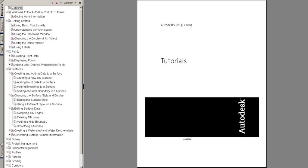
From the "Help" menu > "Tutorials" we will find the link to the 244 page Civil 3D Tutorials PDF.

This got me thinking about two things. Firstly, how many other PDFs are available in the box? A quick search turned up the following 16 PDFs:
Civil_3D_GSG.pdf -- Getting Started Guide (150 Pages)
acad_nag.pdf -- Network Administrator's Guide (126 Pages)
acad_sig.pdf -- Stand-Alone Installation Guide (52 Pages)
acmaparxdev.pdf -- ObjectARX Developer's Guide (title page only)
ADMS_Implementaion_Guide_5.pdf -- Vault Implementation Guide (80 Pages)
adsk_nlg.pdf -- Network Licensing Guide (56 Pages)
adsk_slg.pdf -- Stand-Alone Licensing Guide (18 Pages)
best_practices.pdf -- Best Practices for Managing Geospatial Data (120 Pages)
3C3DStockSubassemblyHelp.pdf -- Subassembly Referece Guide (414 Pages)
civil_tut.pdf -- Civil 3D Tutorials (244 Pages)
civil_ug.pdf -- Civil 3D User's Guide (2716 Pages) This is no typo
FDG_FDODevGuide.pdf -- FDO Devloper's Guide (324 Pages)
FET_TheEssentialFDO.pdf -- The Essential FDO (56 Pages)
Managing_Your_Data_5.pdf -- Managing Your Data for Auodesk Civil 3D (38 Pages)
map2007_tutorials.pdf -- Map 3D Tutorials (76 Pages)
map_ug.pdf -- Map 3D User's Guide (1466 Pages) Yep, that's right
My second thought was... why is one of the Civil 3D world's biggest rockstars -someone with his own fan club- posting at that hour on a Friday night. Surely he could be hanging with his groupies or something.
We may never know. But something good came of it, and for that I thank him.
From the "Help" menu > "Tutorials" we will find the link to the 244 page Civil 3D Tutorials PDF.
This got me thinking about two things. Firstly, how many other PDFs are available in the box? A quick search turned up the following 16 PDFs:
Civil_3D_GSG.pdf -- Getting Started Guide (150 Pages)
acad_nag.pdf -- Network Administrator's Guide (126 Pages)
acad_sig.pdf -- Stand-Alone Installation Guide (52 Pages)
acmaparxdev.pdf -- ObjectARX Developer's Guide (title page only)
ADMS_Implementaion_Guide_5.pdf -- Vault Implementation Guide (80 Pages)
adsk_nlg.pdf -- Network Licensing Guide (56 Pages)
adsk_slg.pdf -- Stand-Alone Licensing Guide (18 Pages)
best_practices.pdf -- Best Practices for Managing Geospatial Data (120 Pages)
3C3DStockSubassemblyHelp.pdf -- Subassembly Referece Guide (414 Pages)
civil_tut.pdf -- Civil 3D Tutorials (244 Pages)
civil_ug.pdf -- Civil 3D User's Guide (2716 Pages) This is no typo
FDG_FDODevGuide.pdf -- FDO Devloper's Guide (324 Pages)
FET_TheEssentialFDO.pdf -- The Essential FDO (56 Pages)
Managing_Your_Data_5.pdf -- Managing Your Data for Auodesk Civil 3D (38 Pages)
map2007_tutorials.pdf -- Map 3D Tutorials (76 Pages)
map_ug.pdf -- Map 3D User's Guide (1466 Pages) Yep, that's right
My second thought was... why is one of the Civil 3D world's biggest rockstars -someone with his own fan club- posting at that hour on a Friday night. Surely he could be hanging with his groupies or something.
We may never know. But something good came of it, and for that I thank him.
Thursday, July 27, 2006
Autodesk Labs
I am not certain why I had not mentioned this before, but Autodesk has a new section at their website where they are making available new stuff under development. Non-disclosure agreements are not required. This makes the technology previews available "public betas" (with all of the disclaimers that go along with that). The new section is called Autodesk Labs.
There are currently three previews available
Autodesk DGNV8 Translator Beta - Added June 19th, 2006
Installs on all language versions of:
AutoCAD 2007
Autodesk Architectural Desktop 2007
Autodesk Building Systems 2007
AutoCAD Electrical 2007
AutoCAD Mechanical 2007
Google Earth Extension Beta - Added June 28th, 2006
Installs on all language versions of:
AutoCAD 2007
Architectural Desktop 2007
AutoCAD Civil 3D 2007
AutoCAD Map 3D 2007
Project Freewheel Technology Preview - Added July 4th, 2006
Freewheel is both a web site where you can type in an DWF URL for interactive viewing, and a web service that allows you to embed an interactive DWF viewer in your own HTML page.
The main reason I thought to mention this now was that someone asked in a discussion group how to get basic AutoCAD entities into Google Earth. The "Google Earth Extension Beta" would likely work best for him.
There are currently three previews available
Autodesk DGNV8 Translator Beta - Added June 19th, 2006
Installs on all language versions of:
AutoCAD 2007
Autodesk Architectural Desktop 2007
Autodesk Building Systems 2007
AutoCAD Electrical 2007
AutoCAD Mechanical 2007
Google Earth Extension Beta - Added June 28th, 2006
Installs on all language versions of:
AutoCAD 2007
Architectural Desktop 2007
AutoCAD Civil 3D 2007
AutoCAD Map 3D 2007
Project Freewheel Technology Preview - Added July 4th, 2006
Freewheel is both a web site where you can type in an DWF URL for interactive viewing, and a web service that allows you to embed an interactive DWF viewer in your own HTML page.
The main reason I thought to mention this now was that someone asked in a discussion group how to get basic AutoCAD entities into Google Earth. The "Google Earth Extension Beta" would likely work best for him.
Monday, June 19, 2006
Civil 3D 2007 - SP1A On Its Way
Civil 3D 2007 Service Pack 1 seems to correct several issues with the product, but there is one item that it seems to break (there is a work-around, see below).
A couple of users pointed this out to me and there is mention of it in the Discussion Groups also. When you have a Parcel with Labels in ModelSpace everything appears fine. Then when you switch to PaperSpace (a Layout) the Parcels Labels disappers. This is not good.
Dan Philbrick the Autodesk Civil 3D Development Manager mentioned in the Discussion Groups that Service Pack 1A (which corrects this one issue) should be available Wednesday, June 21, 2006.
Workaround: In order to plot properly from a layout you can use either Land Desktop or Land Enabled Autodesk Map.
If I have not stated it lately the Discussion Groups are a GREAT way to...
get questions answered...
find tips, tricks, and workarounds...
see what is causing others issues...
offer advice for the benefit of the industry...
make requests and wishes...
BASICALLY IMPROVE!
A couple of users pointed this out to me and there is mention of it in the Discussion Groups also. When you have a Parcel with Labels in ModelSpace everything appears fine. Then when you switch to PaperSpace (a Layout) the Parcels Labels disappers. This is not good.
Dan Philbrick the Autodesk Civil 3D Development Manager mentioned in the Discussion Groups that Service Pack 1A (which corrects this one issue) should be available Wednesday, June 21, 2006.
Workaround: In order to plot properly from a layout you can use either Land Desktop or Land Enabled Autodesk Map.
If I have not stated it lately the Discussion Groups are a GREAT way to...
get questions answered...
find tips, tricks, and workarounds...
see what is causing others issues...
offer advice for the benefit of the industry...
make requests and wishes...
BASICALLY IMPROVE!
Preview Beta of the Autodesk® DGN V8 Translator
Shaun Hurley mentions in his blog that Autodesk is making available this preview beta as of today (June 19th, 2006) for AutoCAD 2007 based software. This is not needed in Civil 3D 2007 Land Desktop 2007, and Map 3D 2007 because they already contain this feature.
Visit Shaun's Blog for instruction on how to acquire the Beta
Visit Shaun's Blog for instruction on how to acquire the Beta
Friday, June 02, 2006
Map 3D 2007 Service Pack 1
For those of you that have seats of Map 3D 2007 also in your organizations, last week, Autodesk released Service Pack 1 for Map 3D 2007. It only installs on the full seat of Map 3D 2007 not anything else.
Tuesday, April 11, 2006
Bootcamp Day Three - Vault, Map 3D, and Raster Design
Well, it was one busy day. Far too much information for just one post. Here is the smallest of tiny snippets.
The first half, 4 hours, was spent exploring Autodesk Vault. It will be like learning to ride a bike. It is not immediate. Ultimately, it is not incredibly hard, and actually can be somewhat empowering. A few will likely find it tough. But, with proper guidance it should be very useful. Remember I mentioned PROPER GUIDANCE. The fact that some will try to implement this on their own, the "We are engineers after all" group, will likely lead a few to some frustration. But then again, what does not. Even learning to tie your shoes had to be taught. There will be some change in how things are done, and some individuals and companies embrace change more willingly than others.
If we choose to embrace it (not necessary for small projects and project teams) it can be very useful. Because it is going to be new for most, and it requires certain steps and decisions that some would rather not make at this point in time, I can see some as avoiding it. But, that will be as futile as was avoiding the dawn of automobiles and aviation. Things will be different.
As for Map 3D and Raster Design. My favorite new ability was draping an image on a 3D surface with Raster Design. This definitely reminded me of Google Earth.
The first half, 4 hours, was spent exploring Autodesk Vault. It will be like learning to ride a bike. It is not immediate. Ultimately, it is not incredibly hard, and actually can be somewhat empowering. A few will likely find it tough. But, with proper guidance it should be very useful. Remember I mentioned PROPER GUIDANCE. The fact that some will try to implement this on their own, the "We are engineers after all" group, will likely lead a few to some frustration. But then again, what does not. Even learning to tie your shoes had to be taught. There will be some change in how things are done, and some individuals and companies embrace change more willingly than others.
If we choose to embrace it (not necessary for small projects and project teams) it can be very useful. Because it is going to be new for most, and it requires certain steps and decisions that some would rather not make at this point in time, I can see some as avoiding it. But, that will be as futile as was avoiding the dawn of automobiles and aviation. Things will be different.
As for Map 3D and Raster Design. My favorite new ability was draping an image on a 3D surface with Raster Design. This definitely reminded me of Google Earth.
Thursday, April 06, 2006
Off To Dallas
You may have read or heard that beginning Sunday (Yes, Sunday), Autodesk is holding a conclave, I mean Bootcamp for resellers. Among the many attendees, those of us that support the Infrastructure Solutions Division (ISD) (Autodesk-ese for Civil Engineering, Land Planning and Surveying) will ALL go through the same training for Civil 3D 2007, Map 2007, Raster Design 2007, and AutoCAD 2007.
We will be shown as much of the new stuff as can be stuffed into 5 days. This should include the new project management (Autodesk Vault), survey, grading, and labeling capabilities. I hope to post frequently to give glimpses and impressions.
I will be getting there a little early in an attempt to...
1. Clear my head for the arrival of new information and...
2. For some long needed R&R (suggestions needed).
I certainly am looking forward to this Bootcamp, and to seeing friends and acquaintances in the industry.
Oh, by the way, this in the 200th post to this blog, and a day or two ago the 50,000th visit occured. Thank you for taking the time to check here for information. Based on the increase in daily visits, clearly interest in Civil 3D is on the rise.
We will be shown as much of the new stuff as can be stuffed into 5 days. This should include the new project management (Autodesk Vault), survey, grading, and labeling capabilities. I hope to post frequently to give glimpses and impressions.
I will be getting there a little early in an attempt to...
1. Clear my head for the arrival of new information and...
2. For some long needed R&R (suggestions needed).
I certainly am looking forward to this Bootcamp, and to seeing friends and acquaintances in the industry.
Oh, by the way, this in the 200th post to this blog, and a day or two ago the 50,000th visit occured. Thank you for taking the time to check here for information. Based on the increase in daily visits, clearly interest in Civil 3D is on the rise.
Friday, March 31, 2006
2005 Product Discontinuations
Autodesk has made known, that due to legals reasons, the following products will be discontinued as of May 1, 2006:
Autodesk Civil 3D 2005
Autodesk Map 3D 2005
Autodesk Land Desktop 2005
Autodesk Civil Design 2005
Autodesk Survey 2005
What does this mean? It means that users of these 2005 products will not be able to purchase these products after May 1, 2006. It also means that these same users will not be able to obtain any NEW activation codes, for stand alone licenses, nor a network license after May 14, 2006. This also applies to subscription holders who would under normal circumstances be allowed to use (get activations for) older versions of software instead of a newly purchased seat.
This does not affect user of 2004, or 2006.
Why is this happening? Because of the legal requirement to discontinue support for DGN v8 capability which was embedded in the installation of the 2005 products Autodesk is forced to stop selling the 2005 line of products.
What about 2006? Because the DGN v8 component was on a separate disc, which will be pulled, the 2006 family of products is not affected.
What about 2004? Because this component was not included with the 2004 family of products they are not affected.
Will the 2007 products contain DGN v8 support. Yes, Autodesk has created it's own tool for this, versus the one that they licensed before.
For any existing licences that will require a new activation code due to computer replacement or upgrade this will not prevent them from getting the replacement activiation code.
All users of Land Desktop 2005 should contact their resellers to get a complete clear picture of their options.
Autodesk Civil 3D 2005
Autodesk Map 3D 2005
Autodesk Land Desktop 2005
Autodesk Civil Design 2005
Autodesk Survey 2005
What does this mean? It means that users of these 2005 products will not be able to purchase these products after May 1, 2006. It also means that these same users will not be able to obtain any NEW activation codes, for stand alone licenses, nor a network license after May 14, 2006. This also applies to subscription holders who would under normal circumstances be allowed to use (get activations for) older versions of software instead of a newly purchased seat.
This does not affect user of 2004, or 2006.
Why is this happening? Because of the legal requirement to discontinue support for DGN v8 capability which was embedded in the installation of the 2005 products Autodesk is forced to stop selling the 2005 line of products.
What about 2006? Because the DGN v8 component was on a separate disc, which will be pulled, the 2006 family of products is not affected.
What about 2004? Because this component was not included with the 2004 family of products they are not affected.
Will the 2007 products contain DGN v8 support. Yes, Autodesk has created it's own tool for this, versus the one that they licensed before.
For any existing licences that will require a new activation code due to computer replacement or upgrade this will not prevent them from getting the replacement activiation code.
All users of Land Desktop 2005 should contact their resellers to get a complete clear picture of their options.
Thursday, March 30, 2006
AutoCAD 2007 New Features Workshop
Since it's introduction, I have liked the "New Feature Workshop" inside of Autodesk products. It provides a way of reviewing most of the major new items in recent releases of the product.
As someone that may provide support to many versions of AutoCAD, Land Desktop, or Civil 3D it is useful for reminding me when a feature was added.
AutoCAD 2007 has been released, and many already have it installed. Because Civil 3D 2007, will be built on Map 3D 2007, which itself is built upon AutoCAD 2007, the "New Features Workshop" (NFW) for AutoCAD 2007 can contain important new information.
Autodesk has provided a link to an online version for the latest NFW. Click on the title of this post to see it. Remember, this one is only for the AutoCAD Portion.
As someone that may provide support to many versions of AutoCAD, Land Desktop, or Civil 3D it is useful for reminding me when a feature was added.
AutoCAD 2007 has been released, and many already have it installed. Because Civil 3D 2007, will be built on Map 3D 2007, which itself is built upon AutoCAD 2007, the "New Features Workshop" (NFW) for AutoCAD 2007 can contain important new information.
Autodesk has provided a link to an online version for the latest NFW. Click on the title of this post to see it. Remember, this one is only for the AutoCAD Portion.
Wednesday, March 01, 2006
Civil 3D 2007

As Autodesk introduces the NEW family of 2007 products (shipping in the next month or two) there will be lots to talk about. Here we will focus of course on Civil 3D 2007. What will be there? What will not? I will mention a few general topics today with detailed posts in the near future.
Lets begin.
One of the most obvious additions to Civil 3D is the entirely new Survey functionality and the survey observation object.
The Project environment will now be managed by the core data management capabilities of Autodesk Vault. It will allow for the sharing of:
Points
Surfaces
Alignments
Profiles
Pipe Networks (NEW)
Survey Data (NEW)
Corridors will create named surfaces directly. We will no longer have to export non-associated surfaces. We will also be able to select an existing polyline as a corridor boundary (cool). There will be new subassemblies.
Profiles will now be element-based (free, floating, fixed). This allows for similar constraints as horizontal alignments.
Grading Feature Lines will be controlled by a new set of tools which include the ability, similar to LDt, to create offsets with elevational differences.
Quick sections will be able to be created from AutoCAD objects.
We will be able to create a Pipe Network from a polyline and create an alignment from an existing pipe network. Pipe interference detection will be possible.
Styles management will include the ability to Merge, Copy, or Rename any duplicates found during drag-and-drop operations.
Labels will be able to contain data from various object types in our models. We will be able to include expressions (formulas) in a label style. The labeling of lines, arcs and polylines with style based labels will be possible. I am confident that many will appreciate that masks will be able to be added to labels to hide object behind the label.
We will be able to reset a Point's elevations based on an existing surface. Changing an individual point's rotation angle graphically will be possible.
LandXML 1.1 support for survey and corridor data will help matters.
These are just a few of the enhancements that caught my eye. These plus those found in AutoCAD 2007 and Map 3D 2007 (because Civil 3D is built on top of these products) will give us lots benefit from.
OK, that is enough for now. As I said, I hope to add comments and details in the coming days, and weeks, as time permits.
Friday, October 14, 2005
Map 3D Mini Demonstrations
Not all Civil 3D users know that it is built on top of Map 3D which itself is built on top of AutoCAD. This means that the capabilities of Map 3D are available to Civil 3D users.
For those users that do not know much about Map 3D the title of this post is linked to an Autodesk webpage that contains ten 1-3 minute mini demonstrations showing some of the Map 3D capabilities. Two that are of particular interest are:
Drawing Cleanup
3D Surfaces
Drawing Cleanup because it can greatly increase the users ability to fix drawings with errors, and 3D surfaces because Map 3D surfaces are the same as Civil 3D surfaces.
If nothing else a user should know about the bells and whistles even if they will never use them. Although, with some progressive thinking and a little bit of initiative users may see the usefulness for a whistle here or a bell there.
For those users that do not know much about Map 3D the title of this post is linked to an Autodesk webpage that contains ten 1-3 minute mini demonstrations showing some of the Map 3D capabilities. Two that are of particular interest are:
Drawing Cleanup
3D Surfaces
Drawing Cleanup because it can greatly increase the users ability to fix drawings with errors, and 3D surfaces because Map 3D surfaces are the same as Civil 3D surfaces.
If nothing else a user should know about the bells and whistles even if they will never use them. Although, with some progressive thinking and a little bit of initiative users may see the usefulness for a whistle here or a bell there.
Friday, September 30, 2005
Service Pack 2 Is Here
Today, Autodesk posted Service Pack 2. It Includes Autocad 2006 SP1, Map 2006 SP1, as well as Civil 3D 2006 SP1. The service pack resolves issues in many segments of the product ie. Points, Alignments, etc.
The title of this post is linked to the Service Pack 2 download Page.
Note: You must also install Land Desktop 2006 Service Pack 1 in order to use the migration capability in Civil 3D 2006 or if these two products are both installed on the same machine.
The title of this post is linked to the Service Pack 2 download Page.
Note: You must also install Land Desktop 2006 Service Pack 1 in order to use the migration capability in Civil 3D 2006 or if these two products are both installed on the same machine.
Subscribe to:
Posts (Atom)
